Enhancing Agriculture with Drones: Crop Monitoring & Management
Advancements in drone technology are transforming agriculture, helping farmers monitor crops more efficiently and improve overall farm management. With
aerial photography, drones provide real-time data that enhances decision-making, reduces waste, and increases productivity. From tracking plant health to assessing soil conditions, drones are becoming an essential tool in modern farming.
The Role of Drones in Agricultural Monitoring
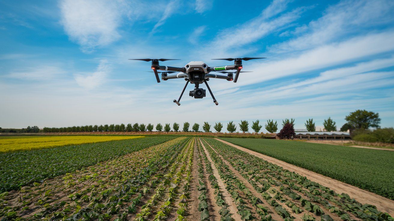
Drones allow farmers to monitor large fields quickly and accurately, helping them detect potential issues before they become serious. With high-resolution imaging, they can identify:
- Crop diseases – Spot early signs of infections.
- Pest infestations – Identify affected areas for targeted treatment.
- Nutrient deficiencies – Ensure crops receive the right fertilisation.
By drone photography, farmers can better understand their land’s condition without relying solely on manual inspections.
How Drone Photography Enhances Crop Management
Efficient crop management relies on accurate data. Drones provide detailed images that reveal:
- Plant health and growth patterns.
- Moisture levels in the soil.
- Areas needing fertiliser or pesticides.
With
drone services, farmers can create precise field maps, optimise irrigation, and apply treatments only where necessary, reducing costs and environmental impact.
Drone Services for Precision Agriculture
Precision agriculture uses data-driven decision-making to maximise productivity. With drone photography, farmers can:
- Assess soil conditions.
- Predict crop yields.
- Improve planting strategies.
- Monitor livestock movements.
Drones also support automated spraying, ensuring that pesticides and fertilisers are used efficiently, reducing waste and improving sustainability.
Finding the Right Drone for Agricultural Use
Selecting the best drone for photography in agriculture depends on several factors, including:
- Camera quality – High-resolution imaging for detailed analysis.
- Flight time – Longer battery life for covering large fields.
- Mapping capabilities – GPS and sensor integration for precision mapping.
Fixed-wing drones cover vast areas efficiently, while multi-rotor drones offer better manoeuvrability for detailed inspections.
Applications of Drone Aerial Photography in Farming
Drones are used for a variety of agricultural applications, including:
- Crop scouting – Identify problem areas quickly.
- Field mapping – Plan planting strategies more effectively.
- Irrigation management – Detect overwatered or dry areas.
Farmers can improve resource allocation and ensure better crop health by leveraging drone photo technology.
Understanding Drone Photography Prices for Agricultural Use
The cost of drone services varies based on:
- Equipment type – Advanced drones with thermal imaging cost more.
- Flight duration – Longer flights increase operational costs.
- Analysis level – NDVI mapping and other advanced imaging may add to the price.
While drone photography prices may seem high initially, the long-term benefits of improved efficiency and reduced waste make it a worthwhile investment.
How to Find Drone Photography Near You for Agricultural Needs
When searching for drone photography near me, consider the following:
- Experience – Look for providers with agricultural expertise.
- Equipment quality – Ensure they use high-resolution cameras and advanced drones.
- Customer reviews – Check testimonials and previous work.
Choosing a reputable service ensures accurate data and better farm management outcomes.
Why Choose Professional Drone Services?
Although consumer drones are available, professional services provide:
- Specialist expertise in agriculture.
- High-quality imaging and advanced mapping capabilities.
- Reliable and actionable data for farm management.
Working with professionals ensures that farmers receive precise insights to enhance productivity.
Drones are revolutionising agriculture, offering innovative solutions for monitoring and crop management. By providing real-time data, aerial photography helps farmers detect issues early, improve resource allocation, and boost yields. As technology advances, drones will continue to play a crucial role in modern farming, making agriculture more efficient and sustainable.
For farmers looking for reliable and high-quality drone solutions, Drone Photography Manchester offers expert services tailored to agricultural needs. We provide:
- State-of-the-art drone technology.
- High-resolution imagery for precision agriculture.
- Expert analysis to support better decision-making.
With a commitment to accuracy and efficiency, we help farmers optimise their operations effectively.
Check our new X update about how drone photography is transforming agriculture!